
Orbitfy Edge Maritime Intelligence provides advanced analytics for identifying and locating suspicious vessels, monitoring marine activity, and analyzing shipping behavior globally.
Orbitfy Edge Maritime Intelligence
Orbitfy Edge Maritime Intelligence provides advanced analytics for identifying and locating suspicious vessels, monitoring marine activity, and analyzing shipping behavior globally.
Description
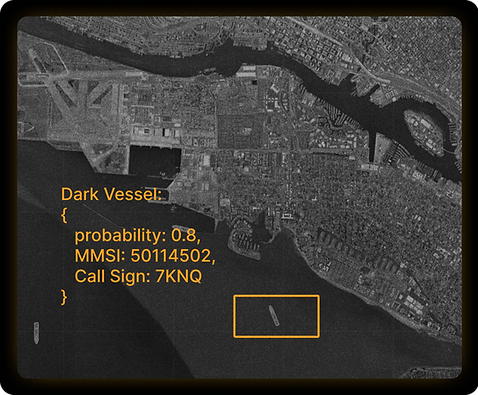
Orbitfy Edge Maritime Intelligence is a comprehensive service designed to provide in-depth insights into global maritime activity. It leverages high-resolution vessel detection models and timely AIS (Automatic Identification System) data to identify and locate suspicious vessels. Users can set up alerts for unprecedented marine activity within their areas of interest, ensuring timely notification of critical events. The platform also allows for the analysis of shipping activity over time for any location on the planet, offering historical context and trend identification. Furthermore, it provides insights into vessel behavior and characteristics by utilizing imagery, enabling a deeper understanding of maritime operations. This service is ideal for applications requiring robust maritime surveillance and intelligence.