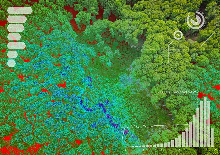





SaraniaSat's core service: multi-platform (drone/aircraft/balloon/satellite) hyperspectral data acquisition combined with proprietary sensor-fusion analytics, delivering actionable remote-sensing insight within about 24 hours of acquisition.
H3 Hyperspectral Data Acquisition & Analytics
SaraniaSat's core service: multi-platform (drone/aircraft/balloon/satellite) hyperspectral data acquisition combined with proprietary sensor-fusion analytics, delivering actionable remote-sensing insight within about 24 hours of acquisition.
Description
SaraniaSat's flagship offering is its "H3" hyperspectral remote-sensing acquisition-and-analytics service, a combined hardware/software solution rather than a discrete satellite component. The H3 methodology interoperates across drones, aircraft, high-altitude balloons and satellite platforms, using customized instruments to acquire hyperspectral imagery, which is then processed with SaraniaSat's proprietary non-linear, weak-signal-detection and sensor-fusion algorithms. This lets the company enhance signals of interest against noisy backgrounds and select, prioritize and fuse the specific hyperspectral bands most relevant to a customer's question, converting raw multi-platform data into decision-ready information often within 24 hours of acquisition.
Rather than delivering generic third-party imagery, SaraniaSat designs its data-acquisition strategy around the specific information content a customer needs for their business vertical -- a positioning the company summarizes as solving the gap between "data acquirers," who collect imagery without regard to end-use, and "data analyzers," whose output quality is capped by the data they are given. The service is delivered through three linked solution tracks: Research & Development (pilot projects that tailor the platform to a customer's specific pain points, typically maturing into a subscription-based engagement), Legacy Data (ensuring new hyperspectral data products integrate cleanly with a customer's existing, often decades-old, operational systems and best practices), and Data Analytics (SaraniaSat's core value-add -- decimating hyperspectral "big data" into a complete, prioritized, actionable picture of the phenomenon under study).
The primary commercial application is precision agriculture: detecting nutrient deficiencies, weeds, disease and predicting insect infestations before they affect yield, supporting daily farm-management decisions, crop-insurance underwriting, and crop financial-market analysis. SaraniaSat also applies the same H3 methodology to government projects, covering civil remote sensing (environmental monitoring, water-resource management, forestry, land-use planning) and defense-oriented situational-awareness use cases. As a specialized analytics firm, SaraniaSat does not manufacture or sell satellites, sensors or other space hardware as standalone products -- its catalog is this single, tailorable data-and-analytics service applied across the agriculture and government verticals.
Specifications
| Acquisition platforms | Drone, aircraft, balloon, satellite (multi-platform "H3") |
|---|---|
| Sensor type | Hyperspectral imaging |
| Processing approach | Proprietary non-linear weak-signal detection + sensor fusion |
| Typical turnaround | ~24 hours from acquisition to actionable information |
| Engagement model | Pilot project -> subscription-based service |
| Primary verticals | Precision agriculture; government civil & defense remote sensing |