The Cognitive Infrastructure for Spectrum Intelligence
 Kawa Space
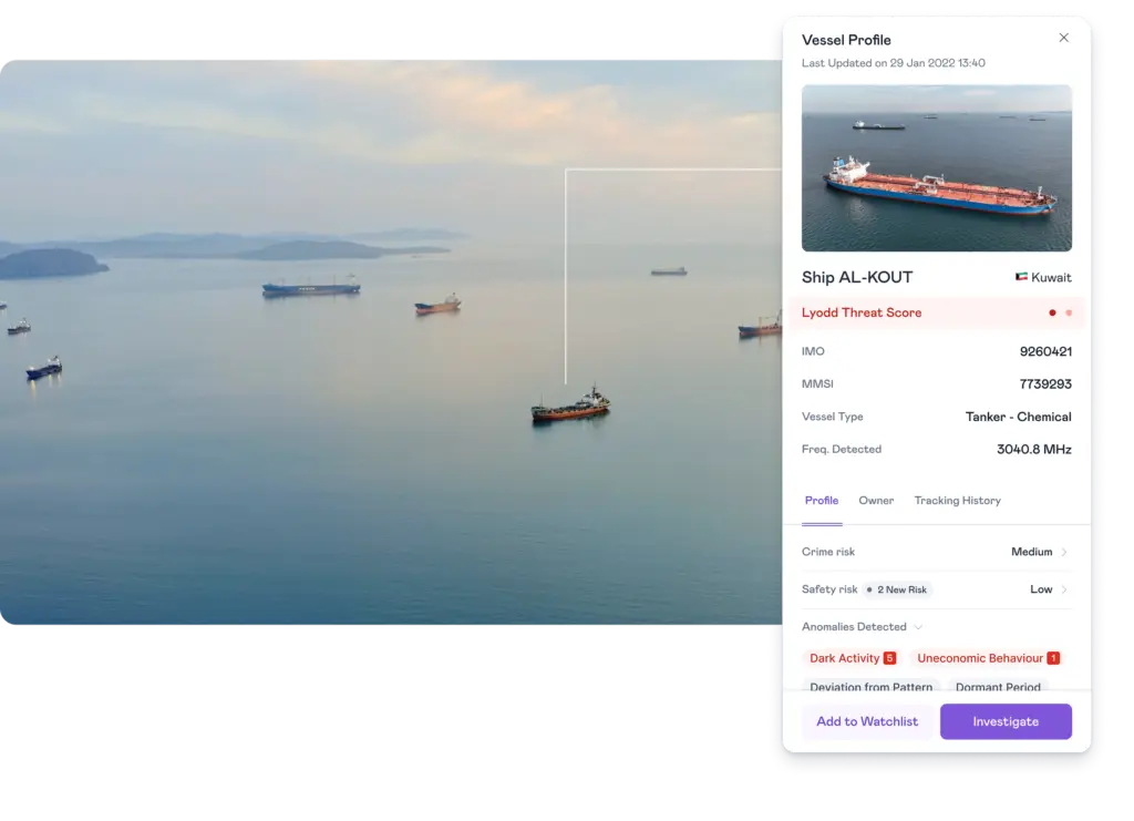
A cognitive infrastructure leveraging 18 satellites to collect and process radio frequency signals for spectrum intelligence across land, sea, air, and space, delivering insights in seconds.
Technical specifications
- Satellites
- 18
- Frequency range
- Upto 18 GHz
- Operating system for processing
- Kawa’s Aura OS
- Operating system for on-demand tuning
- Kawa OS
- Data delivery format
- JSON
- Data delivery methods
- API or Kawa Studio Platform
About
The Cognitive Infrastructure for Spectrum Intelligence provides rapid intelligence by collecting and processing radio frequency signals from a constellation of 18 satellites, covering frequencies up to 18GHz. This system is designed to deliver intelligence in seconds, not days, across various domains including land, sea, air, and space. Key use cases include National Security (NatSec) applications, enhancing ISR programs with increased visibility of risks, on-ground activities, and persistent monitoring of RF emitters. For Maritime Intelligence, it identifies and tracks vessel activity globally, offering S & X full band scan and correlation with AIS Data, and uses ML/AI models to geolocate and track dark vessels. Powerful MDA software is available to explore full profiles of vessels of interest. Land-Based Applications focus on improving area domain awareness by tracking and localizing anomalous behavior, detecting land-based emitters, locating L band phones, telecom deployments, and other communication infrastructure with global coverage and near-real-time revisit. The system allows for tuneable frequency on-demand using Kawa OS. The technology involves data collection by 18 satellites, signal processing and emitter geolocation using Kawa’s Aura OS, and delivery of geointelligence data (Longitude, Latitude, Time, and relevant emitter data points) in JSON format via API or the Kawa Studio Platform. Kawa Studio acts as a unified command center for operating, managing, and deriving Signal and Geospatial Intelligence. It offers custom tasking and data fusion, allowing users to task RF, Multispectral, and SAR satellites on demand and fuse RF data with imagery for faster intel. It also provides RF Native capabilities to request IQ data with a click of a button and is designed for teams with custom dashboards for managing orders and a collaborative environment for sharing findings.
Documentation
No public datasheet yet — request the datasheet / ICD from the supplier.