GNOMES — GNSS Radio Occultation Weather Data Constellation
 PlanetiQ
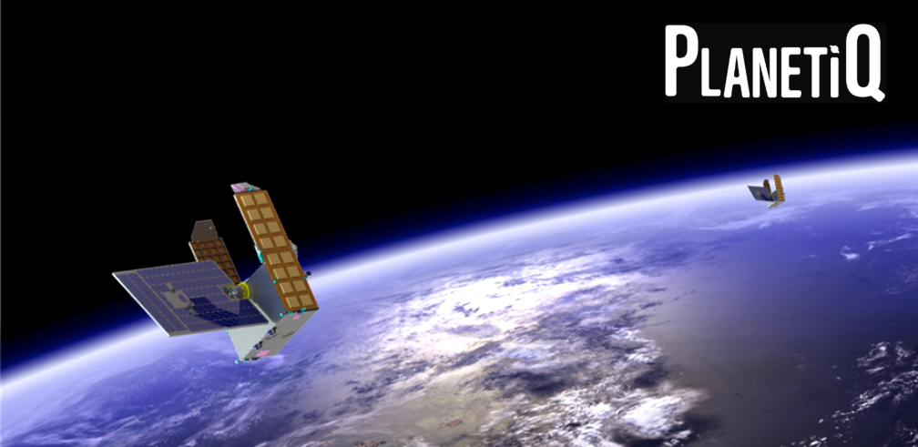
PlanetiQ's GNOMES constellation delivers the world's highest-accuracy GPS radio occultation weather data: 2,500 soundings/day per satellite, 100 m vertical resolution, <3 min latency, tracking GPS/GLONASS/Galileo/BeiDou — rated 'Best-in-Class' by NASA CSDA; 5 satellites operational.
Key figurescomparable across the catalogue
- Mass
- 30 kg
Normalised to common units so this product can be compared with others in its category. The supplier's own wording is below.
As published by the supplier
- Constellation name
- GNOMES (GNSS Navigation and Occultation Measurement Satellite)
- Satellites operational
- 5 (GNOMES-1 through GNOMES-5, 2020–2024)
- Satellite mass
- ~30 kg
- Satellite bus
- Blue Canyon Technologies (BCT) XB
- Orbit
- Sun-synchronous LEO, 525–645 km
- Instrument
- Pyxis GNSS-RO sensor (4th generation, NASA/COSMIC-2 heritage)
- GNSS signals tracked
- GPS L1/L2, GLONASS L1/L2, Galileo E1/E5b, BeiDou B1/B2
- Signal-to-noise ratio
- ~2,000 V/V (~10× competitors)
- Vertical resolution
- 100 m
- Data rate
- 100 Hz (GPS/BDS3/GLONASS), 125 Hz (Galileo)
- Soundings per satellite per day
- 2,500
- Planned full constellation output
- 50,000+ soundings/day (20 satellites)
- Data latency
- <3 minutes average (via geostationary relay)
- Downlink
- X-band 8.260 GHz, 10 Mbit/s nominal
- Atmospheric variables
- Temperature, pressure, humidity, refractivity, wind, TEC, electron density
- Gnomes-5+ capability
- Polarimetric RO — precipitation, cloud ice, soil moisture, flood detection
- Key customer
- NOAA (operational delivery since July 2023)
- NASA rating
- Best-in-Class (CSDA program)
- Historical archive
- 4+ years
About
GNOMES (GNSS Navigation and Occultation Measurement Satellite) is PlanetiQ’s LEO constellation of weather satellites delivering commercial radio occultation (GNSS-RO) atmospheric data. Each ~30 kg satellite, built on a Blue Canyon Technologies XB bus, carries PlanetiQ’s Pyxis instrument — a fourth-generation GNSS-RO sensor with NASA/COSMIC-2 heritage — in sun-synchronous orbit at approximately 525–645 km altitude. The Pyxis sensor tracks signals from four GNSS constellations simultaneously (GPS L1/L2, GLONASS L1/L2, Galileo E1/E5b, BeiDou B1/B2), achieving a signal-to-noise ratio of approximately 2,000 V/V — roughly 10× higher than competing commercial GNSS-RO instruments — which enables vertical atmospheric profiling at 100 m resolution (vs. 200–400 m for competitors) from the surface to the stratosphere. Each satellite generates approximately 2,500 radio occultation soundings per day; a planned 20-satellite constellation would deliver 50,000+ soundings/day and approximately 400 million data points per day. Data latency averages under 3 minutes via geostationary relay links. Level 1B products include calibrated carrier phase and SNR data for neutral atmosphere, ionospheric scintillation, and Total Electron Content (TEC). Level 2 geophysical retrievals include temperature, pressure, density, refractivity, humidity, wind speed/direction, and electron density profiles. Starting with GNOMES-5 (launched August 2024 on SpaceX Transporter-11), satellites carry dual-linear polarization antennas enabling polarimetric RO measurements for heavy precipitation profiling, vertical cloud ice structure, soil moisture, and flood detection. PlanetiQ has delivered daily operational data to NOAA under an IDIQ contract since July 2023 and is rated ‘Best-in-Class’ by NASA’s Commercial Smallsat Data Acquisition (CSDA) program. A 4+ year historical archive is available for AI/ML weather model training.
Documentation
No public datasheet yet — request the datasheet / ICD from the supplier.