QPS-SAR
 iQPS (Institute for Q-shu Pioneers of Space)
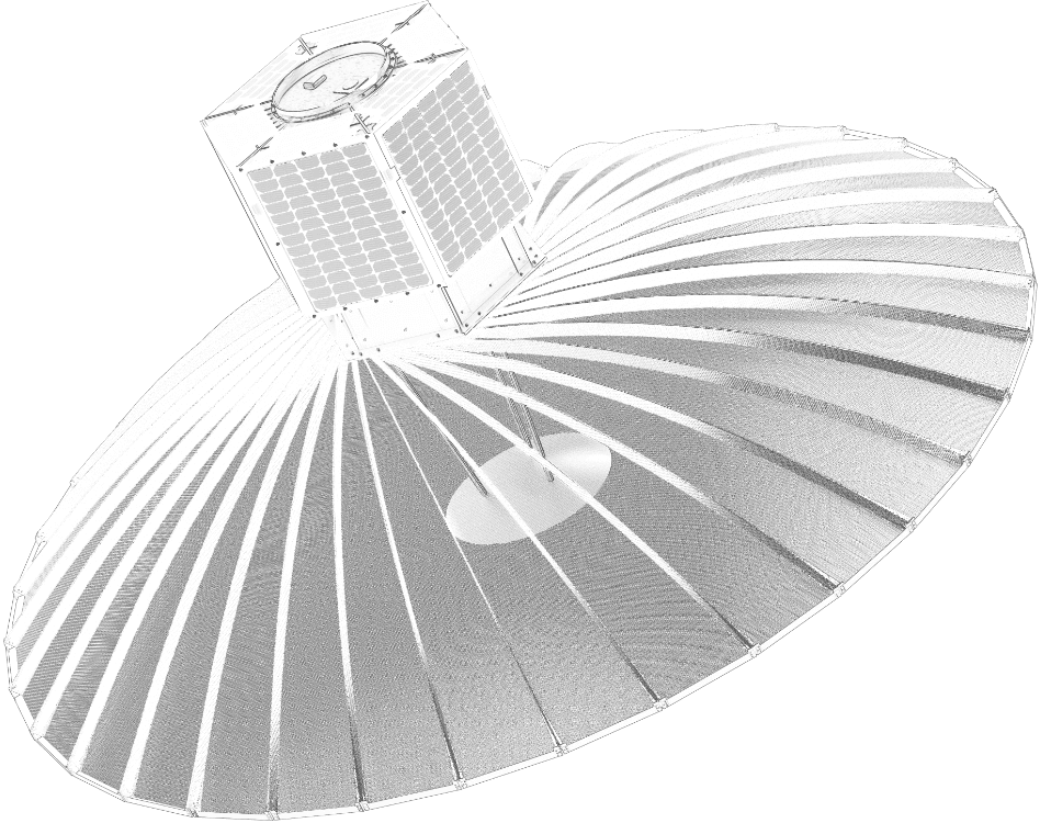
High-resolution small synthetic aperture radar (SAR) satellite built and operated by iQPS for day/night, all-weather Earth observation.
Key figurescomparable across the catalogue
- Power
- 2,000 W
Normalised to common units so this product can be compared with others in its category. The supplier's own wording is below.
As published by the supplier
- Frequency
- 9.6 GHz (X-band)
- Look direction
- Left or right in direction of movement
- Imaging mode
- Stripmap Mode, Spotlight Mode
- Antenna size
- 3.6 m (diameter)
- Operational orbit
- Sun-Synchronous Orbit (SSO) and Inclined Orbit
- Bandwidth
- Up to ~600 MHz
- Peak radiated power
- 2,000 W
- Polarization
- HH or VV
- Off-nadir angle
- 15-50 degrees
- Propulsion system
- Available (onboard)
- Stripmap resolution (azimuth x ground range)
- 1.8 m x 0.46 m (at 30 deg off-nadir, 525 km altitude, 600 MHz bandwidth)
- Stripmap scene size
- 14 km x 7 km
- Spotlight resolution (azimuth x ground range)
- 0.46 m x 0.46 m (at 30 deg off-nadir, 525 km altitude, 600 MHz bandwidth)
- Spotlight scene size
- 7 km x 7 km
- Data processing levels
- L1.1 SLC, L1.1 SLA, L1.1 MLA, L1.2 (ground range projected), L1.3 (ortho with DEM)
- Data formats
- GEOTIFF, SICD
About
QPS-SAR is iQPS’s small synthetic aperture radar (SAR) satellite, designed, manufactured, and operated by the company as the space segment of its Earth observation constellation. Unlike optical imaging satellites, QPS-SAR uses X-band radar to image the Earth’s surface regardless of daylight or cloud cover, using a large 3.6 m deployable antenna to achieve high-resolution imagery from a compact small-satellite platform.
Each QPS-SAR satellite operates in Stripmap or Spotlight imaging modes, with a peak radiated power of 2,000 W and a bandwidth of up to 600 MHz, and can look left or right of the ground track with an off-nadir angle of 15-50 degrees. Satellites are equipped with an onboard propulsion system for orbit maintenance and are deployed into Sun-synchronous or inclined orbits. In Spotlight mode, the satellite has demonstrated commercial imaging resolution as fine as 0.46 m x 0.46 m.
iQPS has launched a growing series of QPS-SAR satellites (including IZANAGI, IZANAMI, AMATERU I-IV, TSUKUYOMI I-II, SUSANOO-I, WADATSUMI-I, YAMATSUMI-I, KUSHINADA-I, YACHIHOKO-I, and SUKUNAMI-I) as it builds toward a constellation of 24 satellites by 2028 and 36 by 2030, enabling near-real-time regional observation at an average 10-minute revisit interval. Imagery is delivered at multiple processing levels (Single Look Complex, Single/Multi Look Amplitude, ground-range projected, and DEM-orthorectified products) in GEOTIFF and SICD formats, ordered and delivered through iQPS’s tasking and archive console with API access.
Documentation
No public datasheet yet — request the datasheet / ICD from the supplier.