BiodiversityView — National Habitat Mapping & Condition Scoring
 Map Impact
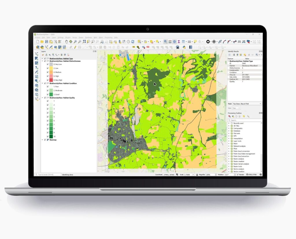
Map Impact's BiodiversityView maps 60+ UKHab habitat types across Great Britain at ~50 m resolution using Sentinel-2 imagery, calculates DEFRA Biodiversity Metric 4.0 Habitat Units and scores condition (Poor/Moderate/Good) on an H3 hexagonal grid — updated annually.
Technical specifications
- Satellite data
- Sentinel-2 (ESA Copernicus), archive from 2015
- Habitat types mapped
- 60+ (UKHab classification)
- Spatial resolution
- ~50 m (H3 hex grid, Resolution 11, ~0.2 ha/cell)
- Condition score
- 1–3 (Poor / Moderate / Good)
- Metric standard
- DEFRA Biodiversity Metric Calculator 4.0 (Habitat Units)
- Additional data sources
- 15+ open datasets: UKCEH Land Cover Maps, Natural England Priority Habitats, NatureScot, OS, OSM, topographic/bathymetric
- Processing platform
- Google Earth Engine + Microsoft Azure
- Update frequency
- Annual
- Coverage
- Great Britain
About
BiodiversityView is Map Impact’s satellite-powered national habitat mapping and condition scoring platform covering Great Britain. It uses Sentinel-2 multispectral imagery (ESA Copernicus programme, historical archive from 2015 to present with high revisit frequency) processed through Google Earth Engine and Microsoft Azure cloud pipelines to map over 60 UKHab habitat types at approximately 50 m resolution — on an H3 hexagonal spatial grid at Resolution 11 (≈29 m edge length, ≈0.2 ha per cell). Each cell is scored 1–3 for habitat condition: Poor, Moderate, or Good. Habitat Unit values are calculated in alignment with the DEFRA Biodiversity Metric Calculator 4.0, making outputs directly usable for biodiversity net gain assessments, planning applications, and ecological impact analysis in the UK context. Beyond Sentinel-2, the platform fuses 15+ open authoritative datasets including UK Centre for Ecology & Hydrology Land Cover Maps, Natural England Priority Habitats Inventory, NatureScot inventories, Ordnance Survey mapping, OpenStreetMap, and topographic/bathymetric data. BiodiversityView is used by property developers, local planning authorities, ecologists, insurers, and land managers for ecological baseline surveys, biodiversity net gain assessments, and environmental due diligence. Map Impact is a UK-based geospatial analytics company founded in 2023.
Documentation
No public datasheet yet — request the datasheet / ICD from the supplier.