EarthLife Tasking & Analytics Platform
 SARsatX (CubeSat Arabia)
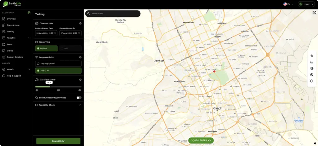
SARsatX's self-service satellite tasking and AI-powered geospatial analytics platform, turning SAR and optical imagery into automated insights, alerts and reports for government and commercial customers.
Technical specifications
- Delivery type
- Software-as-a-service / self-service tasking portal
- Typical delivery time
- 72 hours per tasking request
- Data sources
- SARsatX SAR + optical satellites
- Core capability
- AI change detection, geospatial analytics, automated alerts/reports
- Target sectors
- Agriculture, environment, energy, maritime, defense, urban planning, disaster response
About
EarthLife is SARsatX’s software platform for on-demand satellite tasking and geospatial data analytics. It gives customers a self-service interface to submit new imaging requests directly, with a fully automated scheduling system that routes tasking across SARsatX’s SAR and optical assets, putting mission tasking directly in the hands of end users rather than requiring manual coordination with an operations team.
Once imagery is collected, EarthLife’s processing pipeline combines satellite imagery, AI-driven analytics and geospatial technologies into a single workflow: it ingests Earth observation data from SARsatX’s own satellites (and, where relevant, additional trusted sources), applies AI and geospatial analytics models to detect changes and uncover patterns, and generates visual intelligence, reports and alerts that support day-to-day operational decisions. Because SAR and optical data are time-aligned, EarthLife can combine both modalities to sharpen change-detection accuracy and provide deeper context than either sensor type alone.
The platform is built to serve both public-sector and commercial use cases at scale, from monitoring a single site to tracking thousands of assets simultaneously without added operational complexity. Target applications include precision agriculture (crop health and stress monitoring), environmental and conservation monitoring, oil and gas / mining site surveillance, maritime traffic and illegal fishing detection, disaster response (floods, earthquakes), infrastructure and ground-deformation monitoring, and urban development / smart-city planning. Typical delivery windows advertised for EarthLife-tasked imagery products are around 72 hours per request.
Documentation
No public datasheet yet — request the datasheet / ICD from the supplier.