Thermal Imagery
 Satellite Vu
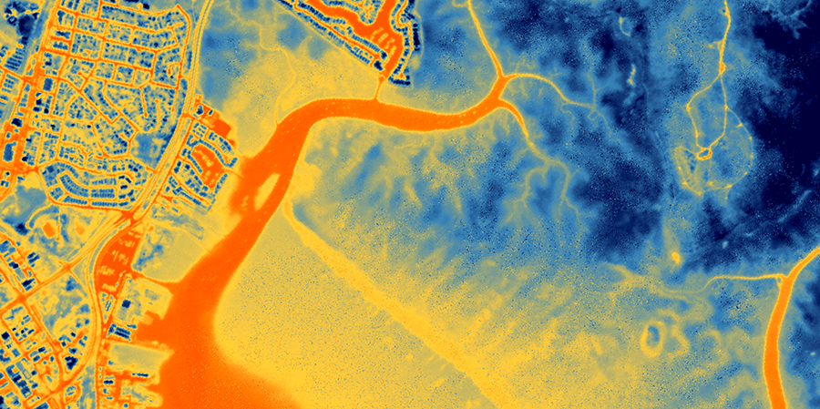
High-resolution day and night thermal infrared satellite imagery at up to 3.5m resolution with 60-second thermal video capability from the HotSat constellation.
Technical specifications
- Wavelength
- 4.5-5 μm day
- Wavelength (night)
- 3.7-5 μm
- Geolocation accuracy
- 15m CE90
- Pixel resolution
- Up to 3.5m at nadir
- Scene size
- 16 km² (~3.5 x 4.5 km at nadir)
- Imaging modes
- Day and Night
- Cloud assessment
- 100% of imagery
- Video capability
- Up to 60-second thermal video
- Delivery formats
- Cloud Optimized GeoTIFF, STAC JSON metadata, PNG thumbnails
- Access methods
- Web platform, REST API, Python SDK
About
Satellite Vu’s Thermal Imagery product delivers high-resolution thermal infrared satellite data from the HotSat constellation, capturing both day and night observations at up to 3.5 metre resolution. Unlike visible-light imagery, thermal data reveals heat signatures invisible to standard optical sensors — enabling detection of industrial activity, building energy efficiency, urban heat islands, and covert infrastructure that would otherwise remain hidden.
Each thermal scene covers approximately 16 km² (roughly 3.5 x 4.5 km at nadir) with geolocation accuracy of 15m CE90. All captured imagery undergoes 100% cloud assessment before delivery. In addition to standard still imagery, SatVu offers up to 60-second thermal video capture, enabling temporal analysis of thermal signatures such as vehicle movement or industrial process cycling.
Data is delivered via the SatVu Platform web application, a RESTful API, or a Python SDK, in Cloud Optimized GeoTIFF format with accompanying STAC-compliant JSON metadata, usable data masks (UDM), and preview thumbnails — enabling direct integration into existing geospatial analysis pipelines.
Documentation
No public datasheet yet — request the datasheet / ICD from the supplier.