Beijing-2 Remote Sensing Satellite Constellation
 21st Century Space
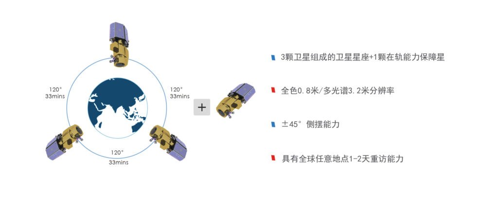
The Beijing-2 remote sensing satellite constellation is China's first commercial remote sensing satellite project approved by the National Development and Reform Commission.
Technical specifications
- Resolution
- 0.8 m panchromatic
- Resolution (multispectral)
- 3.2 m multispectral
About
The Beijing-2 remote sensing satellite constellation project was independently invested by the company and built through a combination of independent research and development and international cooperation. In June 2011, it was signed as a recommended project during a state leader’s visit, witnessed by the heads of government of China and the UK. In July 2015, the Beijing-2 remote sensing satellite constellation was successfully launched. This constellation system includes three optical remote sensing satellites with 0.8-meter panchromatic and 3.2-meter multispectral resolution, as well as an independently developed ground system. It features high spatial resolution, high temporal resolution, and high radiometric resolution, with technical capabilities reaching international advanced levels. It can achieve one to two-day revisit missions for any location globally, providing high spatial and temporal resolution satellite remote sensing big data products and integrated space information application services worldwide. It can provide integrated space information application services and solutions for government scientific governance, resource and environmental monitoring, national security, and national livelihood fields such as “Digital China” construction, as well as major national needs.
Documentation
No public datasheet yet — request the datasheet / ICD from the supplier.