DataCosmos
 Open Cosmos
Web-based Earth observation data platform with back-catalogue imagery, satellite tasking, AI analytics, and API integration for GIS workflows and Python tools.
Technical specifications
- Type
- Earth observation data platform
- Data sources
- SpaceWill, Geosat, Sentinel, Landsat + aerial imagery back-catalogue
- Interface
- Browser-based with tasking, analytics, GIS layers
- Api
- REST API for automated workflows and data pipelines
- Standards
- STAC, Cloud Optimised GeoTIFFs (COG), Python/Jupyter compatible
About
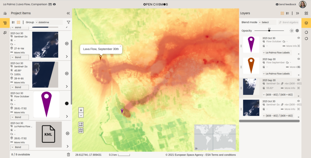
DataCosmos is Open Cosmos’s cloud-based Earth observation data platform, designed to make satellite imagery and derived intelligence accessible and actionable. The platform comes pre-loaded with an extensive back catalogue from multiple imagery providers including SpaceWill, Geosat, Sentinel, and Landsat, plus aerial imagery, providing broad historical coverage from day one. Users can order new tasking directly from the web interface, specifying location, timing, and resolution requirements, and receive imagery integrated into the same environment for immediate analysis. The platform supports on-the-fly band algebra, integrated GIS layers, and integration with third-party partner applications, all within a browser-based environment. For programmatic users, a full REST API provides access to all DataCosmos capabilities, supporting integration into automated decision-making workflows and enabling continuous intelligence pipelines where new satellite acquisitions automatically trigger analysis and alerts. DataCosmos leverages industry standards including Spatio-Temporal Asset Catalog (STAC) and Cloud Optimised GeoTIFFs (COGs) for broad compatibility with existing GIS tools and Python/Jupyter workflows.
Documentation
No public datasheet yet — request the datasheet / ICD from the supplier.