Remote Sensing Data and Services
 NewSpace India Limited (NSIL)
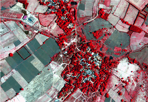
NSIL offers operational remote sensing data and services, including consultancy projects, EO data and value-added products, and customized training courses.
About
Operational remote sensing data and services in India were initiated with the launch of IRS-1A in 1988. India established the National Natural Resources Management System (NNRMS) to utilize data from these satellites. NSIL now offers services through ISRO’s operational remote sensing program, which includes Resources, RISAT, Cartosat, and Oceansat series satellites, with meteorological services provided by INSAT-3D/3DR. NSIL provides Consultancy Remote Sensing and GIS application Projects, leveraging ISRO’s expertise in diverse themes from Agriculture and Forestry to Disaster Management Support. NSIL is also the exclusive disseminator for Indian Remote Sensing (IRS) data finer than 5m GSD, offering state-of-the-art data and products in collaboration with NRSC through the Bhoonidhi portal. Additionally, NSIL facilitates customized training for users through IIRS, a globally renowned institute of ISRO with 50 years of experience in geospatial technology and its applications.
Documentation
- NSIL-Whistle Blower Policy.pdf PDF source: www.nsilindia.co.in ↗
- Citizen Charter (1).pdf PDF source: www.nsilindia.co.in ↗
Need the full ICD, test reports or a specific revision? Ask the supplier directly.