Spacedata – Satellite Imagery Service
 KT SAT
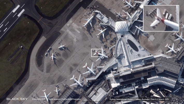
KT SAT offers tailored remote sensing satellite data and solutions for diverse industries, including Electro-Optical (EO) and Synthetic Aperture Radar (SAR) imagery services.
Technical specifications
- BLACKSKY Spatial Resolution
- 0.8m to 1.2m (Gen.2), 35cm (Gen.3)
- BLACKSKY Revisit Rate
- Up to 15 times/Day (approx. 1.5 hours)
- BLACKSKY Image Delivery
- Within 90 minutes after collection
- BLACKSKY Imaging Area per Frame
- 26km² ~ 33km²
- Vantor Spatial Resolution
- 0.3m (0.3~0.5m)
- Vantor Swath Width
- 13km or more
- ICEYE SAR Spatial Resolution
- Up to 0.25m
- ICEYE SAR Imaging Area
- 25km² ~ 84,000km²
- ICEYE SAR Image Delivery
- Within 8 hours after acquisition (average 3 hours)
- ICEYE Total Satellites Launched
- 54 (as of November 2025)
About
KT SAT provides comprehensive Spacedata services, focusing on Satellite Imagery Application. This includes Electro-Optical (EO) satellite imagery, which consists of high-resolution images of the Earth’s surface captured using sensors that detect visible and near-infrared light. KT SAT partners with BLACKSKY (USA), a provider of optical imagery with a spatial resolution of approximately 1m (ranging from 0.8m to 1.2m). BLACKSKY operates both sun-synchronous and inclined orbits, offering a high revisit frequency of up to 15 times per day, suitable for surveillance and reconnaissance. Image acquisition scheduling and ordering are managed through the Spectra® platform. Key features include nineteen Gen.2 microsatellites with 1m class spatial resolution and two Gen.3 satellites with 35cm class resolution (as of November 2025). The revisit rate is approximately 1.5 hours, with image delivery within 90 minutes after collection. Imaging area per frame is 26km² ~ 33km². The service also supports various imaging modes like Daytime, Nighttime, Area 2×1 (merged imageries), Stereo (ONA 10~60deg, DEM), Burst (5 imageries in 15sec), and Detect (AI, Detection of ship, building, plane). Additionally, KT SAT offers Vantor (USA) optical imagery with a spatial resolution of 0.3m (0.3~0.5m), holding an archive of over 125 petabytes accumulated over 20 years. Vantor™ Hub allows on-demand tasking and access to 2D and 3D basemaps. Six WorldView Legion satellites with 30cm class resolution are operated in both sun-synchronous and inclined orbits (as of November 2025). The service also includes SAR (Synthetic Aperture Radar) technology, capable of operating day or night and in all weather conditions, enabling identification of terrain and artificial structures based on texture and patterns. ICEYE (Finland) operates the world’s largest SAR satellite constellation, providing imagery with up to 0.25m resolution, fast delivery (within 8 hours, average 3 hours), and wide-area scan capability. ICEYE has launched 54 satellites (as of November 2025), with imaging areas ranging from 25km² to 84,000km².
Documentation
Need the full ICD, test reports or a specific revision? Ask the supplier directly.