PIESAT-01
 PIESAT Information Technology
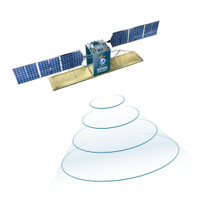
PIESAT-01 is the world's first multi-baseline distributed InSAR satellite system, consisting of four X-band SAR satellites (1 main + 3 auxiliary) flying in formation for global high-resolution SAR imaging and deformation measurement.
Technical specifications
- Number of satellites
- 4 X-band SAR Satellites (1 main + 3 auxiliary)
- SAR imaging resolution (single-star spotlight mode)
- up to 0.5m
- SAR imaging resolution (multi-satellite stitching imaging mode)
- up to 80 km
- Global land-scale mapping coverage
- between 82.5° north and south latitude
- Global land-scale mapping scale
- superior to 1:50,000 scale
- Surface deformation monitoring accuracy
- 3 mm~5 mm per year
- Data product levels
- L0 to L6 (7 levels)
About
The PIESAT-01 is the world’s first multi-baseline distributed InSAR satellite system, comprising four X-band SAR satellites: one main satellite and three auxiliary satellites. These satellites fly in a formation where the main satellite is at the center, and the three auxiliary satellites orbit it in the same elliptical trajectory. The main satellite transmits detection signals to the ground, and the entire constellation synchronously receives the echo signals. This system enables all-day, all-weather, high-resolution, wide-format SAR imaging globally, with a resolution up to 0.5m in single-star spotlight mode and up to 80km in multi-satellite stitching imaging mode. It also provides high-precision, high-efficiency, large-scale terrain measurement. The PIESAT-01 constellation has advanced deformation measurement capabilities, capable of completing global land-scale mapping tasks (between 82.5° north and south latitude, superior to 1:50,000 scale) within one year, achieving surface deformation monitoring data with an accuracy of 3mm~5mm per year. The system offers rich types of data products, including two categories (standard and thematic) and seven levels (L0 to L6), which have broad business application prospects in natural resources, emergency management, municipal transportation, environmental energy, marine, and water body industries. It aims to significantly fill the gap in the domestic InSAR satellite application market. The PIESAT-01 is capable of all-weather, all-day, all-digital, and efficient remote sensing data acquisition, providing high-precision and high-resolution satellite data that is unaffected by cloud cover and light changes. It can assist in environmental protection, surveying terrain, earthquake resistance and disaster mitigation, early warning of weather, fire and flood prevention, and finding scarce resources.
Documentation
No public datasheet yet — request the datasheet / ICD from the supplier.