Soil Moisture Data
 WeatherStream (formerly Orbital Micro Systems)
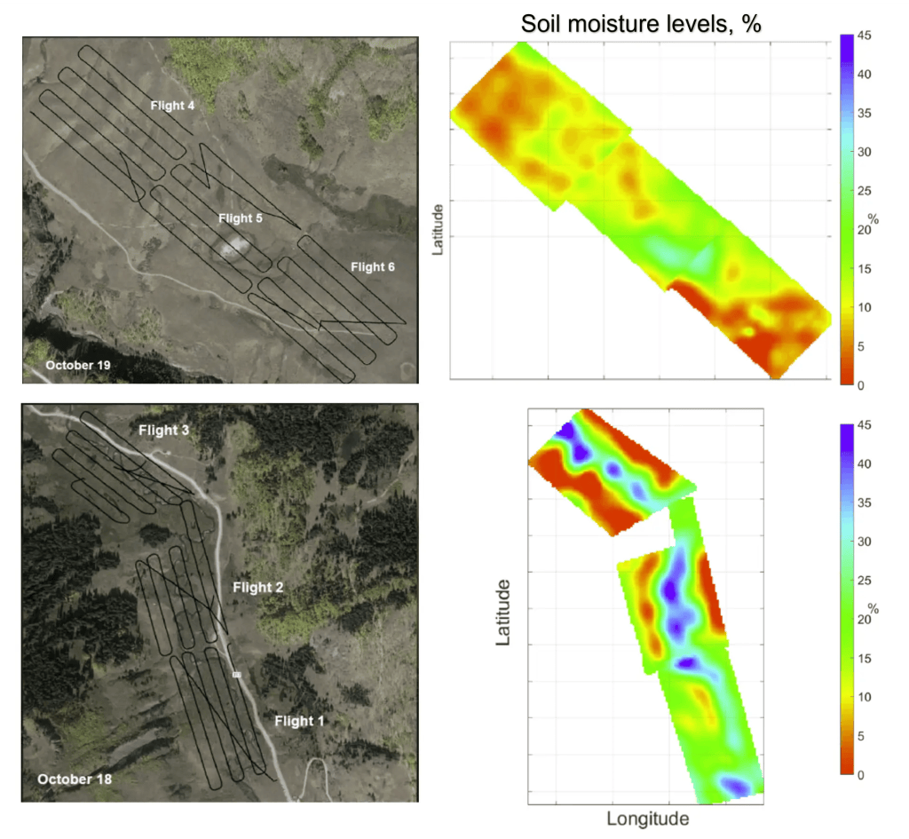
Weather Stream offers high-resolution soil moisture measurements using uncrewed aerial systems, providing detailed soil moisture mapping across various terrains.
About
Weather Stream’s soil moisture data offering is a joint venture between Black Swift Technologies, Weather Stream, and the University of Colorado Center for Environmental Technology. This venture provides innovative hardware and data services for detailed soil moisture mapping. The core technology is a novel, patent-pending L-band Differential Correlation Radiometer, combined with an advanced soil moisture retrieval algorithm. This system delivers high-resolution insights into soil conditions, enabling precise monitoring and analysis in diverse environments. The drone-mounted systems offer greater data coverage and precise measurements of soil moisture levels. The instruments are designed and built in-house by RF experts and are fully customizable to specific needs and requirements. These systems have proven commercial results, having been delivered to multiple customers including NASA, NOAA, US Air Force, University of Colorado, University of Virginia, the USGS, various farms, and golf courses. Flight services are currently available on a limited basis.
Documentation
No public datasheet yet — request the datasheet / ICD from the supplier.