

SPACEBEL provides on-board software and data management solutions for various space missions, including satellite platforms, payloads, and sub-systems, with expertise spanning the entire software development lifecycle.
Flight Segment (On-board Software and Data Management)
SPACEBEL provides on-board software and data management solutions for various space missions, including satellite platforms, payloads, and sub-systems, with expertise spanning the entire software development lifecycle.
Description
SPACEBEL is a leading provider of on-board software and on-board data management, with a history of developing flight software since 1990. Their expertise covers satellite platforms, payloads, sub-systems, space probes, and launchers for Earth observation, science, meteorological, telecommunication, and Space4defence missions. The Flight Segment Department comprises highly qualified flight software engineers who manage the entire lifecycle of flight software development and delivery, from concept studies, analysis, and specification, through architecture, design, and development, to validation, qualification, and integration into the target environment.
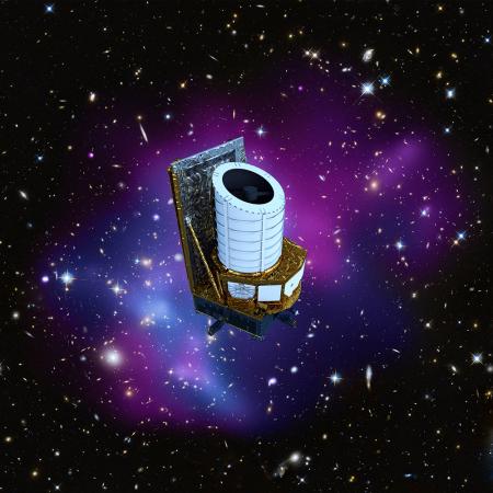
Reference projects include the on-board software for all PROBA satellites (ESA missions), the Central Data Management Unit Application Software for the EUCLID science mission, and the MetOp-SG Microwave Sounder Instrument Control Unit Application software. Other examples are the on-board software for ALTIUS (Earth Observation), the European Space Rider, the central software for the HERA and RAMSES spacecraft (planetary defence), and the Comet Interceptor mission (science).
SPACEBEL's generic on-board software, the Data Handling Software, is platform and mission-independent. It implements the Packet Utilisation Standard (PUS), supports File Based Operations with a standard File Delivery Protocol, and offers a complete solution of on-board control procedures (OBCP). It is designed to run with different executives (potentially multiprocessor and/or separation kernel) and to integrate easily with various Hardware Dependent Software to form an Execution Platform Software. It also provides an Application Framework (AFW) that facilitates the integration of Equipment Managers and mission-specific applications. Regular applications include control of platform functions (thermal control, electrical power management, attitude and orbit control, operational safety and security) and payload management.
Key technologies and skills include on-board software architecture, requirements engineering, design, verification, validation, maintenance, qualification, and the application of modern IT technologies for flight software and related simulators. This encompasses Real-Time Embedded On-Board Software, CCSDS/ECSS Standards, Real-Time Executive for Multiprocessor Systems, Fault Detection Identification Recovery, High autonomy applications and Artificial Intelligence, Operating systems, Space qualified processors and bus drivers, Modelling and code generation tools, Missionisation tools, and Automated test facilities. SPACEBEL is also active in standardisation and advisory groups, contributing to the revisiting of the PUS Standard and the elaboration of the new PUS-C.