SAFEPLACE Wildfire Risk Mapping
 Spacebel
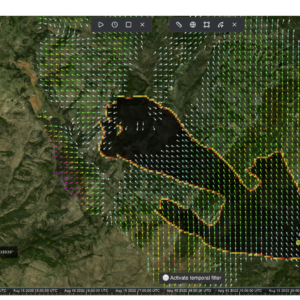
ESA-programme wildfire ignition and spread risk forecasting platform combining 20 years of fire history with satellite and environmental data.
About
Developed within the European Space Agency’s SAFEPLACE programme, Spacebel’s advanced wildfire risk mapping service transforms 20 years of fire history, satellite observations and environmental data into highly accurate risk forecasts. The platform identifies where wildfires are most likely to ignite and spread, with up to 95% prediction accuracy as reported by Spacebel, enabling authorities, infrastructure operators, insurance companies and land managers to take preventive action before disasters occur.
The service delivers actionable insights spanning resource planning, risk mitigation, emergency preparedness and response, helping to protect people, assets and natural environments across Belgium and neighbouring regions. It fuses spaceborne data with environmental, climatic and vegetation insights to generate detailed wildfire susceptibility and fire-ignition risk maps in near real time, intended for civil protection agencies, land managers, public utilities, insurance companies and policymakers.
Documentation
No public datasheet yet — request the datasheet / ICD from the supplier.