Grad-13®
 Bartington Instruments
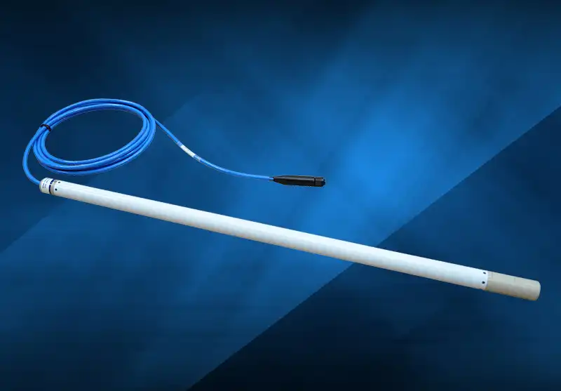
The Grad-13 is a digital three-axis gradiometer providing high resolution vector measurements of magnetic fields on land or in water, ideal for site and downhole surveying, and cable and pipe detection.
Typed specifications45 values
Discloses 8 of 11 fields engineers filter by in this category (category median 8).
- Mass
- 2 000 g nom. · Grad-13-1000L & S · datasheet p.5 2 000 g Grad-13-1000L & S (with standard 5m cable) | 2 000 g Grad-13-1000L & S, with standard 5m cable | 1 400 g Grad-13-500L & S (with standard 5m cable) | 1 400 g Grad-13-500L & S, with standard 5m cable +4
- Measurement range
- 70 µT nom. · datasheet p.4 70 µT full scale magnetometer measuring range option | 100 µT full scale magnetometer measuring range option | 100 µT nom.
- Envelope (L×W×H)
- ø35 x 1177mm + cable Grad-13-1000L · datasheet p.5 ø38 x 1177mm + cable Grad-13-1000S | ø35 x 677mm + cable Grad-13-500L | ø38 x 677mm + cable Grad-13-500S | ø35 x 927mm + cable Grad-13-750L +1
- Noise density
- 0.012 nT/√Hz max · sensor noise, dependent on Sample Sum Count · datasheet p.4
- Supply voltage
- 9 V min · datasheet p.5 32 V max | 9–32 V 9VDC min, 32VDC max
- Power consumption
- 5 W max · typical · datasheet p.5
- Data interface
- RS422 datasheet p.5 RS-422 full duplex, 115.2/460.8/921.6 Kb/s
- Operating temperature
- -30 °C min · datasheet p.5 85 °C max | -30–85 °C
- Sensor type
- fluxgate datasheet p.4
- Axes
- 3 for each sensor · datasheet p.4
- Output type
- digital digital RS422 output · datasheet p.4
- Connector
- Amphenol 62GB-16J12-08PN L · datasheet p.5 Amphenol 62GB-16J12-08PN L (land) | SUBCONN MCOM8M S | SUBCONN MCOM8M S (submersible)
- Survival temperature
- -40 °C min · datasheet p.5 85 °C max | -40–85 °C storage
- Intended use
- ground or laboratory geophysical survey, UXO detection, pipe and cable location · datasheet p.3
- Configuration
- separate sensor head gradiometer, two sensors on one bar, baseline 500/750/1000mm · datasheet p.4
- Zero offset
- 10 nT max · zero field offset (sensor) · datasheet p.4
- Linearity error
- 0.002 % max · datasheet p.4
- Axis orthogonality error
- 0.03 ° max · datasheet p.4
- Bandwidth
- 1 000 Hz min · at -3dB · datasheet p.4
Each value is typed with its unit and measurement condition and cites the datasheet page it was taken from. Nothing is guessed: a field that is absent here has not been published by the manufacturer. machine-extracted ✓ checked by NewSpace Market ✓ manufacturer confirmed by the manufacturer.
As published by the supplier19 lines, in the manufacturer's own wording
- Baselines
- 500 mm to 1000 mm
- Versions
- Land and submersible (200m)
- Measuring range
- ±70 or ±100μT
- Accelerometer range
- ±2 g
- Gradient noise
- <25pTrms/√Hz/m at 1 Hz with 500 mm baseline
- Resolution
- 24-bit oversampled
- Number of axes
- Three
- Sensor Scaling Error
- <±0.1%
- Sensor Cross-axis Scaling Error
- <±0.05%
- Total Field Scaling Error (Sensor)
- <±0.4%
- Total Field Scaling Error (Gradient)
- <±0.3%
- Bandwidth
- >1 kHz
- Sensor Noise
- <12pTrms/√Hz
- Zero Field Offset (Sensor)
- <±10nT
- Perming (Magnetisation Hysteresis)
- <1nT in ±100μT
- Orthogonality error between axes
- <±0.03°
- Start-up/Settling time
- 15 minutes
- Operating temperature
- -30°C to +85°C
- Storage temperature
- -40°C to +85°C
About
The Grad-13® is a digital three-axis gradiometer designed to provide high resolution vector measurements of the strength and direction of magnetic fields. It can be used on land or in water, featuring low orthogonality error and digital correction that enable accurate scalar measurements. This versatile instrument can be used as a standalone unit or integrated into multi-sensor arrays, making it suitable for various applications such as site and downhole surveying, and the detection of cables and pipes. Key features include selectable baselines from 500mm to 1000mm, available in both land and submersible (200m) versions, and a measuring range of ±70 or ±100μT. It also incorporates an integral three-axis accelerometer with a ±2g range, and provides individual sensor and gradient outputs. The gradiometer can be easily connected to a computer using readily available RS422 to USB or Ethernet converters. Its performance is highlighted by a gradient noise of <25pTrms/√Hz/m at 1Hz with a 500mm baseline. Applications extend to the detection of buried magnetic anomalies like unexploded ordnance (UXO) through surface or downhole surveys, geophysical surveys for archaeology and mineral exploration, and precise pipe and cable location.
Documentation
- DS3100.pdf PDF source: bartingtondownloads.com ↗
- OM3100.pdf PDF source: www.bartingtondownloads.com ↗
- AN0030.pdf PDF source: www.bartingtondownloads.com ↗
Need the full ICD, test reports or a specific revision? Ask the supplier directly.