Sich-2-1 (Sich-2-30)
 Yuzhnoye Design Bureau
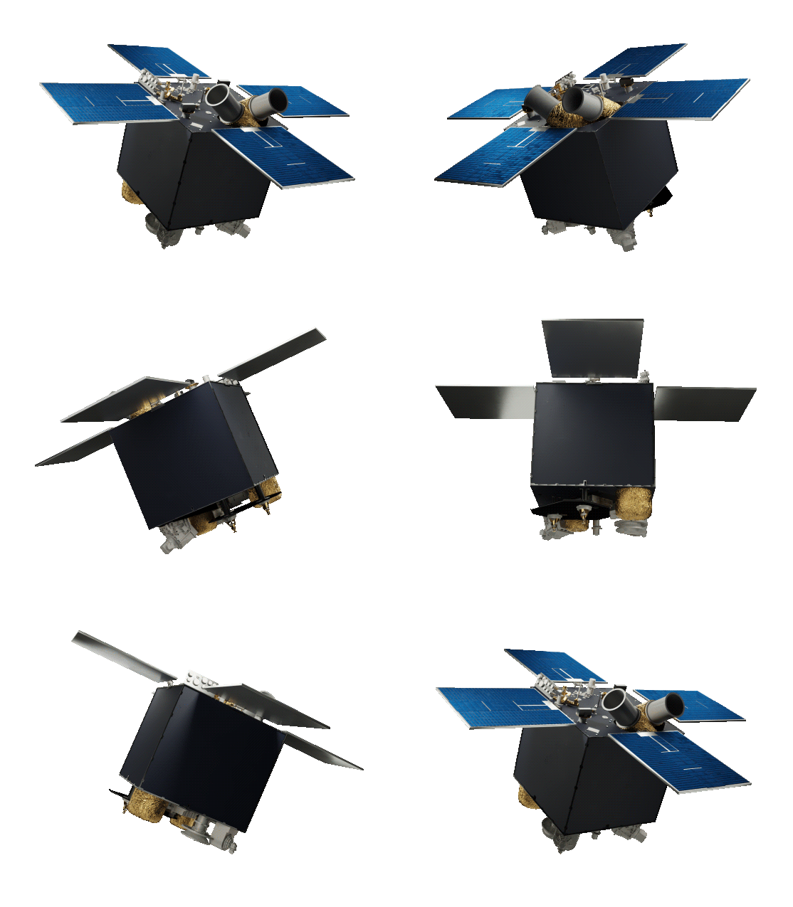
The Sich-2-1 satellite is developed under Ukraine’s National Special-purpose Scientific and Technical Space Program for obtaining visible and near-infrared Earth surface imagery and ionosphere parameter monitoring. It represents an enhanced version following the 2011 Sich-2 satellite launch. Successfully launched on January 13, 2022 aboard a SpaceX Falcon 9 from SLC-40 at Cape Canaveral, the satellite […]
Key figurescomparable across the catalogue
- Mass
- 155 kg
- Payload capacity
- 35.5 kg
- Design life
- 3 years
Normalised to common units so this product can be compared with others in its category. The supplier's own wording is below.
As published by the supplier
- Total mass
- 155 kg
- Payload mass
- 35.5 kg
- Orbit type
- Sun-synchronous
- Orbital altitude
- 500 to 600 km
- Orbital inclination
- SSO +/-0.1 deg
- Local mean solar time
- 10:00 +/- 60 minutes
- Attitude control
- 3-axis active
- Attitude actuators
- Reaction wheels, magnetic actuators
- Off-axis rotation capability
- +/-35 deg
- Attitude accuracy (imaging mode)
- 0.2 deg
- Attitude accuracy (standby mode)
- 5 deg
- Spectral bands
- Green (0.51-0.59 um), Red (0.61-0.68 um), NIR (0.80-0.89 um), Pan (0.51-0.90 um)
- Ground resolution
- ~7.8 m at nadir
- Swath width
- ~46.6 km
- Operational life
- 3 years
About
The Sich-2-1 satellite is developed under Ukraine’s National Special-purpose Scientific and Technical Space Program for obtaining visible and near-infrared Earth surface imagery and ionosphere parameter monitoring. It represents an enhanced version following the 2011 Sich-2 satellite launch. Successfully launched on January 13, 2022 aboard a SpaceX Falcon 9 from SLC-40 at Cape Canaveral, the satellite operates in a sun-synchronous orbit at 500 to 600 km altitude with a local mean solar time of 10:00 plus or minus 60 minutes. Its three-axis active attitude control system uses reaction wheels, magnetic actuators, a star tracker, rate-measuring devices, and a three-axis magnetometer to achieve 0.2 degrees imaging pointing accuracy. The multi-band Earth imager captures imagery in green, red, near-infrared, and panchromatic spectral bands at approximately 7.8 meter ground resolution.
Documentation
No public datasheet yet — request the datasheet / ICD from the supplier.